
Aerial Surveying
Aorangi Aerials provides fast, accurate, and cost-effective aerial surveying solutions using the latest drone and geospatial technology. Whether you're planning earthworks, managing land development, or tracking environmental changes, we deliver precise data to support confident decision-making.
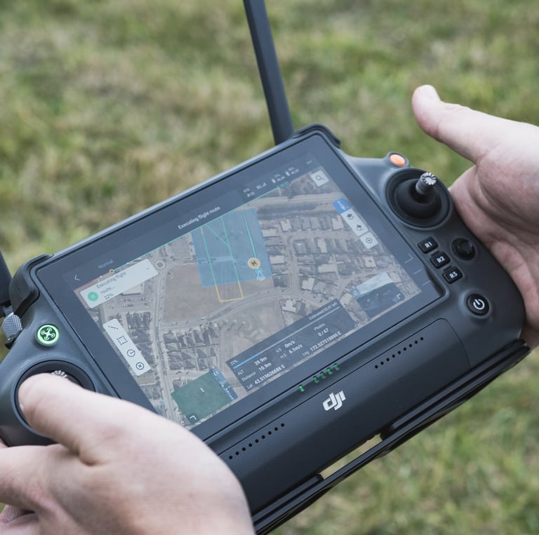
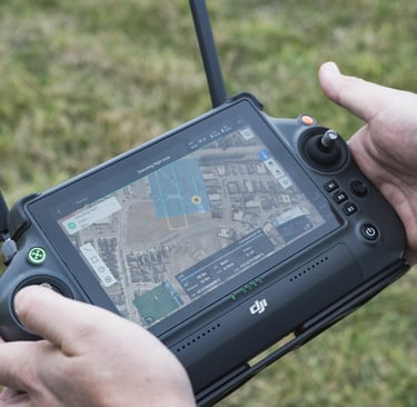
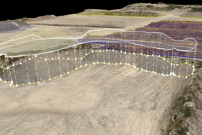
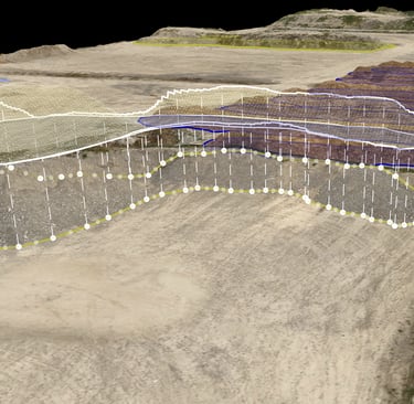
We operate both LiDAR and photogrammetry survey workflows - utilising the DJI Matrice 400 with the Zenmuse L3 LiDAR module for high-precision 3D mapping, and the DJI Mavic 3 Enterprise RTK for rapid and efficient orthomosaic generation. Our survey operations are enhanced by access to local RTK correction services and validated by ground control checkpoints measured with our fleet of EMLID RS2 GNSS rovers and base stations.
Key Equipment:
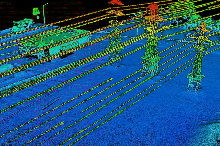
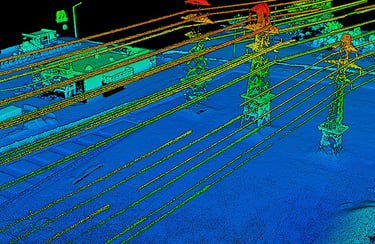
DJI Matrice 400 + Zenmuse L3 LiDAR Module
Real-time point cloud capture with 3cm vertical and 4cm horizontal
accuracy at 120m flight elevation
Accurate ground surface modelling, even through vegetation
Ideal for topographic mapping, contouring, and earthworks planning
DJI Mavic 3 Enterprise RTK
High-resolution aerial imaging with centimetre-level accuracy
Rapid deployment and efficient coverage of large areas
Perfect for orthophotos, stockpile measurements, and site overviews
EMLID RS2 GNSS Receivers
Multi-band, survey-grade accuracy for placing GCPs
Used to independently verify data accuracy and improve spatial fidelity
Deliverables:
We provide your completed survey in a format that works for your project:
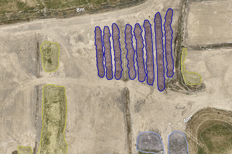
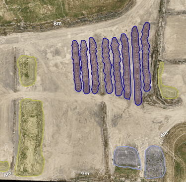
GeoTIFF orthomosaics
Digital Surface Models (DSM) and Digital Terrain Models (DTM)
Contour maps
Point clouds (LAS/LAZ format)
Elevation profiles and volumetric calculations
Printed maps and digital map books
Interactive ArcGIS Online web maps for fast, shareable access and deeper data interrogation
Applications:
Site planning and pre-construction surveys
Environmental impact assessments
Earthworks progress tracking
Farm and vineyard mapping
Asset and infrastructure documentation
Flood modelling and catchment analysis
Why Choose Aorangi Aerials?
RTK-Corrected Accuracy: Every survey is geo-referenced using local correction services and verified with GCPs.
Efficient Turnaround: We process and deliver data quickly, including live access through our ArcGIS Online platform.
Adaptable Delivery: From shapefiles to printed maps and web portals, we tailor outputs to your workflow.
Field-Ready: Our compact and rugged systems can be deployed almost anywhere across New Zealand.
With Aorangi Aerials, you get more than just a map - you get dependable spatial intelligence that helps your project move forward with confidence.
Contact
Our services
hello@aorangiaerials.nz
03 4217 520
Aorangi Aerials © 2026 | Christchurch, New Zealand
All rights reserved.