Your industry made easier with our safe, compliant and efficient aerial solutions.
Industries
Innovative drone services across different sectors.
Agriculture & Horticulture


Accurate, fast and efficient data to help you monitor and grow
- Multispectral Imaging
- High resolution maps
- Interactive 3D models
- Vineyard & orchard monitoring
- Crop health overview
- Drainage and water flow


Conservation
& Pest Control
Identify pests and unwanted animals quickly.
- Pest detection
- Wildlife tracking
- Deer tracking and identification
- Trap lifting to remote locations
- Vegetation monitoring
- Pig hunting
Forestry
View and manage your forest in high definition.
- High resolution maps
- 3D interactive models
- Key forestry metrics


- Terrain modelling
- Biomass calculations
- Tree health monitoring


Security & Surveillance
Interactive 3D models with measurable data for your golf or disc course.
- 3D Modeling
- High resolution maps
- Survey grade mapping
- Accurate elevation/terrain models
- Turf health monitoring
- Drainage analysis
Golf Course Mapping
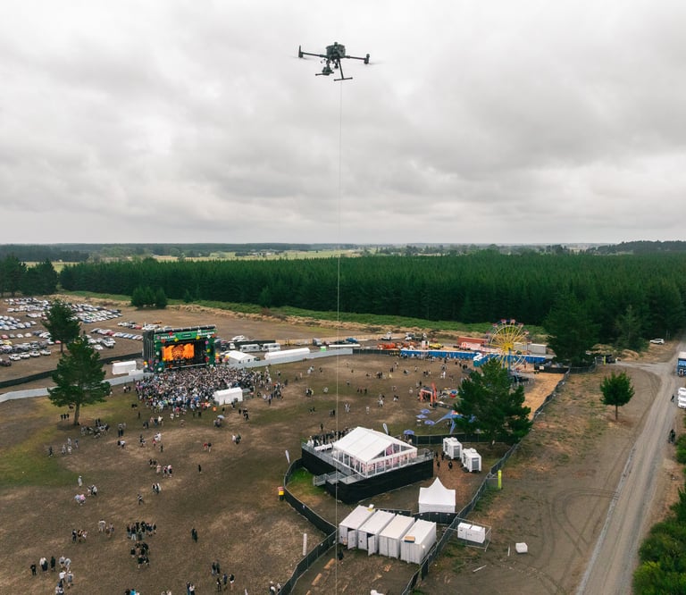
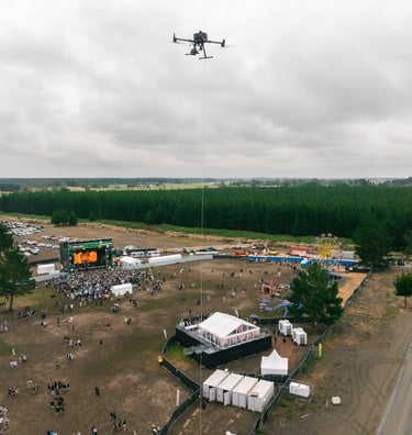
Take the view of your project to new heights with our tethered surveillance solution.
- Event crowd monitoring
- Movement analysis
- crowd disturbance surveillance
- Car park and roadway flow monitoring
- Emergency response
- Entry and exit point monitoring


Utilities
Cost effective, safe and efficient inspections,
scans and mapping of key infrastructure
- Solar panel inspections
- Transmission line inspection
- Powerline vegetation management
- Infrastructure inspections
- Thermal imaging
- LiDAR Scanning


Civil & Construction


View and monitor your sites from above with high resolution measurable mapping.
- Volumetric surveys
- Interactive 3D modelling
- Survey grade mapping
- Consistent monitoring
- Elevation profiles
- Interactive maps with annotations


Surveying & Mapping
Highly accurate mapping from above, safe, cost effective and efficient.
- Orthomosaic mapping
- LiDAR capture
- Digital elevation profiles
- Catchment analysis
- Ground control points
- GNSS hire and services
Contact
Our services
hello@aorangiaerials.nz
03 4217 520
Aorangi Aerials © 2026 | Christchurch, New Zealand
All rights reserved.