Thermal & Multispectral Surveying
Aorangi Aerials is proud to offer advanced thermal and multispectral surveying services to support projects where standard RGB imaging just isn't enough. Whether you're monitoring plant health, detecting heat loss, or identifying environmental anomalies, our specialised sensors provide a powerful layer of insight beyond the visible spectrum.
Our fleet includes industry-leading drone platforms equipped with precision-calibrated thermal and multispectral payloads, enabling us to deliver high-resolution, data-rich imagery that supports decision-making across a wide range of sectors - from agriculture to infrastructure.
Key Features:
Multispectral Imaging
Our multispectral sensors capture data across multiple wavelengths to assess vegetation health, stress levels, and crop performance. This technology is ideal for precision agriculture, environmental research, and land management projects.
Thermal Imaging
Using radiometric thermal sensors, we can detect subtle temperature variations across surfaces. This is particularly useful for identifying heat loss in buildings, locating animals, spotting underground leaks, and conducting search and rescue operations.
Precision Mapping & Analysis
All thermal and multispectral surveys are geo-referenced using high-accuracy RTK positioning and can be integrated into GIS platforms for further analysis. We can deliver your results as downloadable datasets, printed reports, or interactive web maps through our ArcGIS Online portal.
Applications:
Plant health and crop monitoring
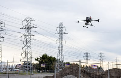
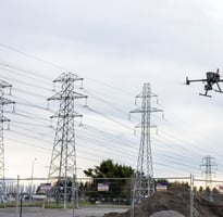
Infrastructure inspections (Thermal leaks, electrical faults)
Wildlife tracking and pest detection
Environmental monitoring
Emergency response and fire risk assessment
When you need to see beyond the visible, Aorangi Aerials brings the tools, experience, and data expertise to give you a clearer picture - no matter the challenge.
Contact
Our services
hello@aorangiaerials.nz
03 4217 520
Aorangi Aerials © 2025 | Christchurch, New Zealand
All rights reserved.